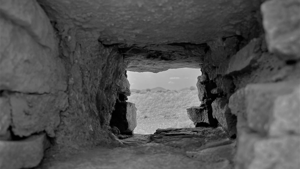
We decided to start our second full day in Flagstaff with a hardy breakfast at Mary’s Cafe, a fixture on Route 66 since 1961. As we’ve come to expect from these old-time roadside diners, the food was great, the service was better, and the coffee kept flowing. After a brief return to Cloud 9 to walk the dogs, we headed out for our driving tour of Wupatki and Sunset Crater Volcano national monuments. The two parks are connected by a 36-mile scenic loop, with a number of major features accessible via short hikes. Near the entrance to Wupatki, we explored the Box Canyon and Lomaki ruins, 900-year-old Puebloan structures made mostly of limestone. From there, we traveled to the Citadel, a pueblo ruin that sits atop a small cinder hill. Constructed in the early 1100s with both sandstone and basalt, the walls follows precisely the outline of the hill.

Finally, 18 miles down the road, we arrived at Wupatki Pueblo, a multi-level high-rise dwelling that had as many as 100 rooms. The vast farming community that occupied the pueblo and surrounding structures had mostly migrated to other areas by 1250, leaving behind a fragile archeological site that, by the early 1900s, required the protection of the federal government from looters and souvenir hunters. President Calvin Coolidge provided that protection by invoking the Antiquities Act and declaring it a national monument in 1924.
Our next destination was Sunset Crater Volcano, a cinder cone that formed as a result of a volcanic eruption between 1040 and 1100. The 1,000-foot-high volcano is a reminder of the powerful forces that shape the earth—forces that have created more than 600 hills and mountains in the San Francisco volcanic field.
Cinder cones are formed when magma (molten rock and highly-compressed gases) sprays high into the air from a central vent in the ground, solidifies, then falls to Earth as large bombs or smaller cinders. As cinders erupted from Sunset Crater, they blanketed older volcanos, creating cinder dunes. The lightest, smallest particles were carried farthest by the wind, covering nearly 800 square miles of Arizona with ash. Perhaps as spectacular as the original eruption were two lava flows: the Kana-a and the Bonito. They destroyed all living things in their path, and left behind a strangely beautiful volcanic landscape.
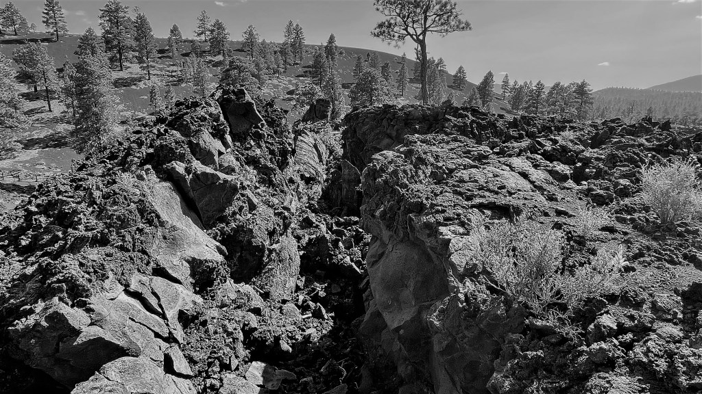
It is thought that the eruption event may have lasted six months to a year. In a final burst of activity, red and yellow oxidized cinders shot out of the vent and fell onto the rim, giving it a colorful glow that reminded people of a sunset (which accounts for the volcano’s name). By the time we arrived at the Bonita Lava Flow, we were pretty tired, so we opted for the “easy” trail at the volcano’s base to see a variety of features, including a “squeeze-up,” partially cooled lava that was pushed through cracks in the crust before solidifying into wedges grooved from scraping against harder rock.
In 1928, filmmakers wanted to create a landslide at Sunset Crater, prompting activists to push for protecting the area. Thus, in 1930, President Herbert Hoover, using the authority given to him through the Antiquities Act, declared Sunset Crater a national monument and added it to the expanding National Park System, “for the benefit and enjoyment of the people.”
Some things we learned along the way are worth sharing:
- The road through the parks is narrow and winding, with soft shoulders. Don’t be tempted to answer emails and text messages while driving.
- Lava is sharp, brittle, and unstable. A fall on cinder or lava is not a pleasant experience.
- Always carry cash. It comes in handy when the visitor center computers are down and debit cards become useless.


